Tajikistan
First some Information:
- Visa: 45 days Evisa or 30 days visa in the Embassy, 50$
- GBOA Permit: 20$
- 24$ Import tax for the car 15 Days, we extended for another 15 days in Khoroug, 15$
- 7$ Tax for some “disinfection”
- Internet is quiet bad and expensive, you can text, but it will be quiet stressful to work online anywhere east of Kulab. Around 10$ for 3GB
- Diesel in the Pamir 1$, in the west around 0,80 Cents, LPG is available outside of the mountains.
- Currency is TJS (Tajik Somoni), 1€ = 10,58 TJS; USD is widely accepted, 1USD = 9,44 TJS
The country
You can split Tajikistan more or less in three parts, the West with the Capital Dushanbe, the North with the City Khujand which is cut off from the rest of the country through the Fan Mountains and the East, Gorno-Badakshan Autonomous Region (GBOA). GBOA covers almost half of the country, but only around 200 000 People (Tajikistan has around 9,3 Millions) are living in this complete crazy mountainous Terrain.
The climate can reach in summer in the Lowland +40°C and -60°C in Winter in the coldest town Bulunkul.
Dushanbe has an altitude of 800m, Ak-Baital Pass (the highest point of the Pamir Highway) is 4655m high, Pik Ismoil Somoni is with 7495m the highest Mountain of the country.
The official language is Tajik (a dialect of Persian) and of course everyone can speak Russian as well. In the West a lot of people speak Uzbek (which is a Turkic language) and in GBOA are many different languages spoken. More or less every valley has its own language.
It is a secular country, but 98% of the population is practicing Islam. So you will see a lot of mosques and also recognize it on the clothing of the locals. GBOA is an exception. Most of the people here follow Isma´ilism, a stream of Shia Islam. You will recognize quickly that the people dress much more open and you will find almost no mosque in this area. Instead there are a lot of Shrines next to the road.
Tajikistan was a part of the Soviet Union and became independent after the fall of the UdSSR. Like in many other states, there was a sudden power vacuum and different groups tried to get the power. The result was a bloody civil war which lasted for 5 year (1992-1997).
The Pamirs
On a clear day in Osh you can see mountains around the city in the distance. The mountains in the south looking a little bit bigger then the others, the Pamirs, also called “The Roof of the world”.
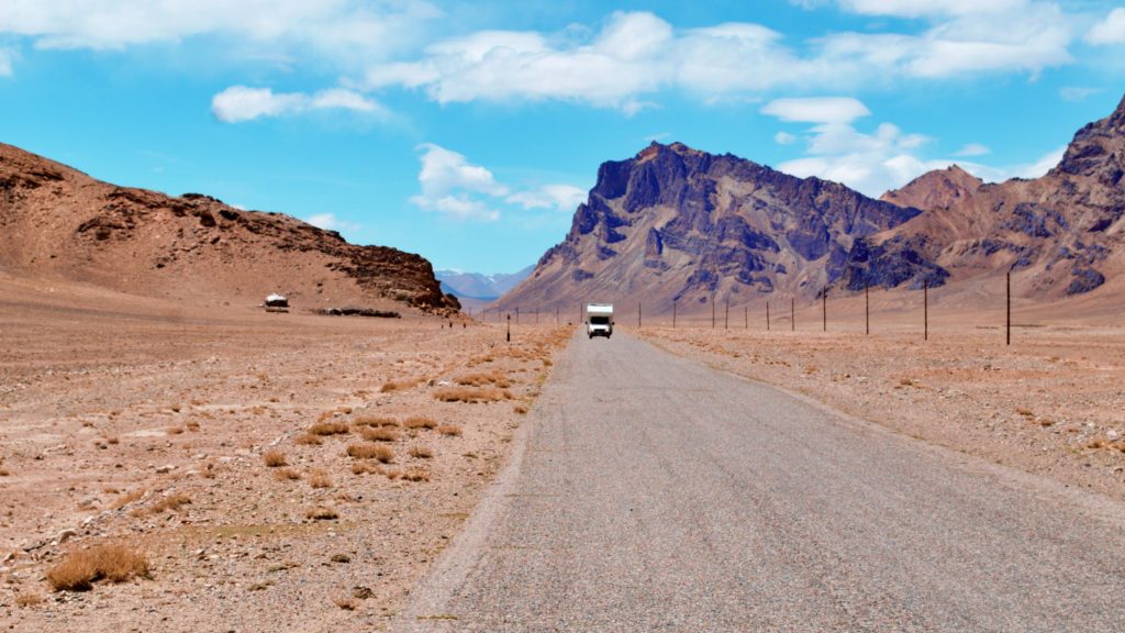
The next day we will drive south to enter the Pamirs on the M41, the Pamir Highway. I heard so many stories about this road. This road is one of the main reason for us to come all the way to Central Asia.
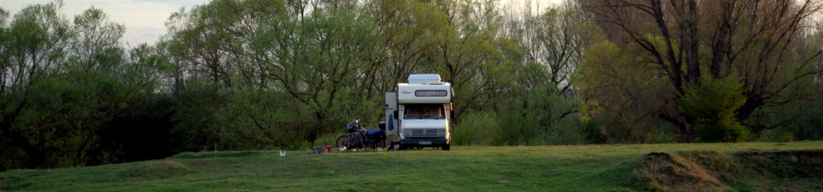
I read articles, saw pictures and videos from people who crossed this mountains. But no one did it with an 1987 Peugeot Mobilehome. I was a little bit nervous to be honest. I knew most of the road will have tarmac, only the passes will be off-road.
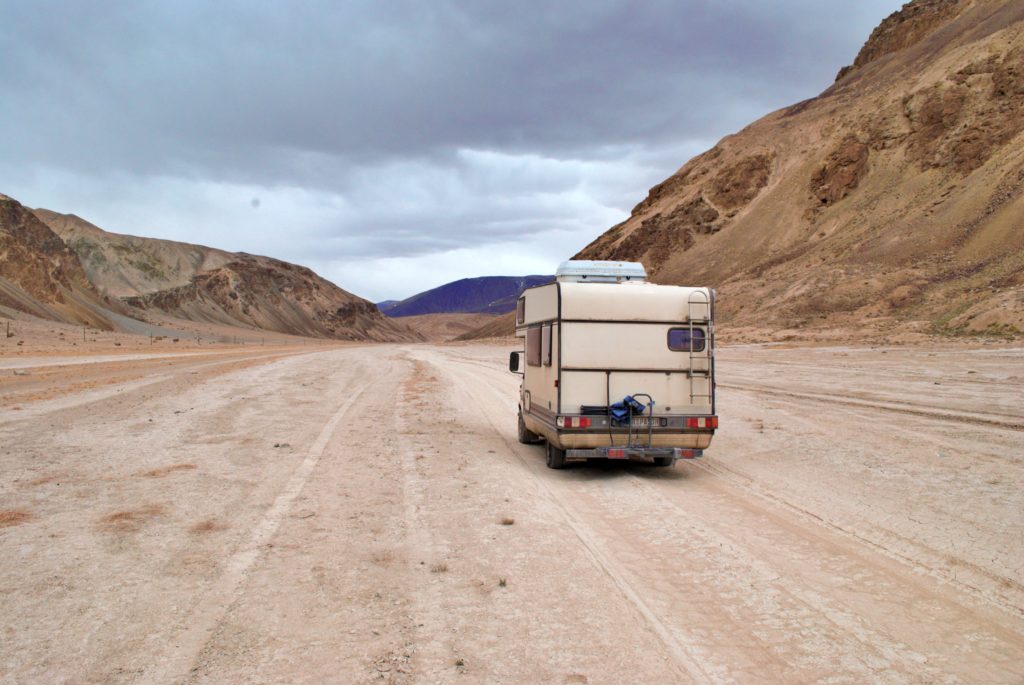
But what does it mean? To use a dirt road in 4655m height, will be a challenge for every kind of car.
Will our van make it?
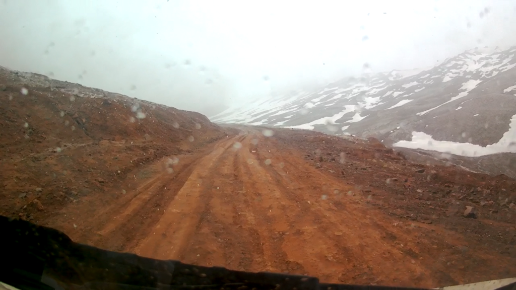
We spent 2 nights at the Peak Lenin Base Camp to get a little bit used to the altitude before we crossed the border to Tajikistan at Kyzyl-Art Pass in 4282m height.
This was our first challenge, the pass is a dirt road and in parts so step that I thought our van with 75 PS will not make it. I constantly steered from right to the left and back, just to give the tires more way to get the height. Luckily the road was not muddy on this day. In some parts you could see 50cm deep tracks from cars, giving you an idea how it can get here.
The Border
A kilometer or so after the pass is a barrier and some huts. It really doens´t look like, but this is the border crossing to Tajikistan. We waited sometime until a border guard came and opened the gates for us. It was a really new experience on a border for me.
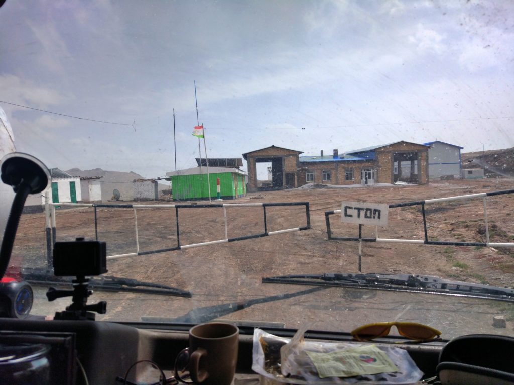
No computer, no nothing! Just a small hut, a table, 2 soldiers and a big book. Important to mention is that they will check your GBOA permit here. You need it when arriving at the border.
After getting the entry stamp you drive around a big skeleton of a hall, after this you will find the hut of the customs office. They will call you inside, be aware to take off your shoes (yes!!). It was impossible to breath inside, they just turned on the heater and there was absolute no oxygen in this room.
They again wrote down every number from the passport, visa and car paper. They were actually friendly to us, we were together with an Iranian speaking friend at this border so we could communicate a little with each other. We paid around 24$ for 15 days vehicle tax.
Once you are done with that, they will send you to another place which called „disinfection“. This is just a joke! I read that some people don´t pay it, but the police insured us that it is official and showed us how they write everything down. In the end is was just 7$ what we had to pay.
This guys really take their time, luckily we were the only one at the border. Later we met with other travelers telling us that they spent 4-5hours on this border because 5-6 cars came at the same time.
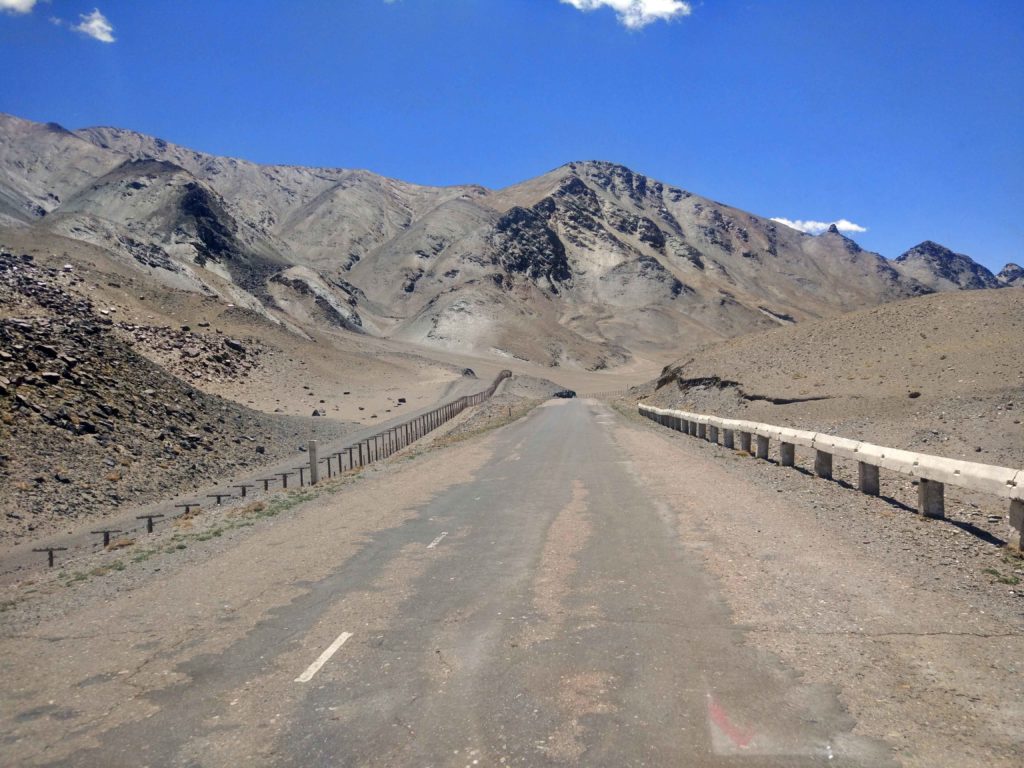
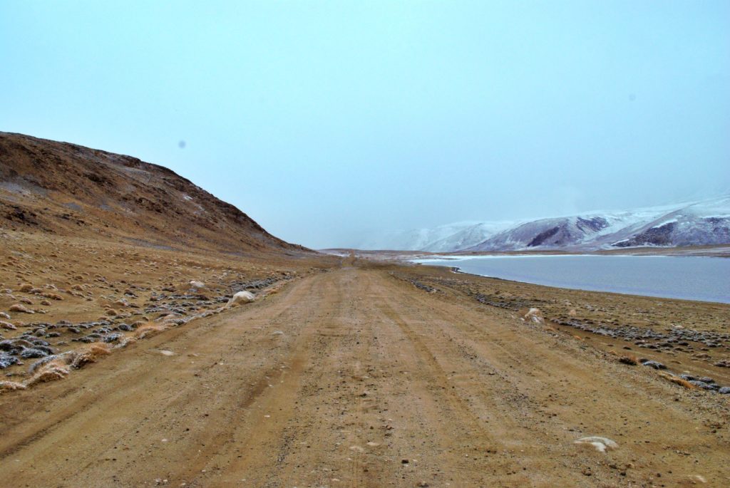
Short after the border I realized “We made it!” This was the Pamirs! The next days we will not get lower then 3900m. To describe the landscape with words will not get anywhere near to the feeling this places gives you.
It is a desert like landscape with huge mountains in the horizon, sometimes you drive inside a canyon or along a beautiful lake. But that´s not the special thing here. It is more the feeling of the remoteness, the harsh weather condition, the beauty of the nature gives you a fearful feeling. We met a lot of bicyclist in this area, I have so much respect of their doings. It must multiply all the feelings I got by 100 being without a engine here.
Another amazing thing here is that people are living here. Some Nomads living in tents, and there ares some towns on the way. We came to this place in June and it was most of the time very windy, cold and even snowing sometimes. We asked the people how could it gets in Winter. The answer was between -35 and -40°C is normal, the record was -57°C in Bulunkul. It is impossible for me to imagine how people can live here.
Once being on that road I forgot my worries about the car, it was fine! The road is in some places in very bad condition and you only can drive very slow. But that´s fine, you will have more time to enjoy the landscape.
But for sure having a 4×4 wheel drive in the Pamir will open you more ways, there is for example the Zorkylsky Nature Refuge on the Afghan Border to which we could not go because of our car.
The Wakhan Valley
Near Bulunkul is the turn into the Wakhan Valley, a 300km dirt road along the Wakhan river, which is the border to Afghanistan. This should be our next challenge.
We didn´t know much about the road conditions, only that it is off road and has a pass over 4000m. We asked many as possible people traveling the road in the other direction. Most of them on a motorbike, some in a rented 4×4 with a driver. The opinions raged from “Yes” to “Impossible!”.
There are a few things Duygu and me are 100% the same, if ten people say “no, it is impossible for you.” We will not listen to them and refer to the 1 person who said, “you can try.”.
When we took the turn my pulse was again high! We knew that if we get stocked, we can just wait until a jeep is passing by. We are at home and have food for another week. So no worries.
There was a motorbike crew just coming out of this road, stopping us and telling us not to drive in this road. It will be impossible for us. We said, “well we will try!” And we did it! First the road is winding up to a pass with over 4000m. It had some tricky passages, but all in all it was easier then the pass on the border.
We reached the top, knowing this was one of the key situation on this road. Unfortunately is was windy and snowy, so we just stopped for Wallace. After she was running around for 10 minutes we continued the small road going down towards Afghanistan.
We passed a few small lakes, houses, sheeps and shepherds. Shortly after the pass you will meet a river, just 20-30m on the other side of the river is Afghanistan. A very special moment for us as well.
You will pass a military checkpoint. You will find checkpoints all over the Pamir Highway and here in the Wakhan Valley is a high presence of soldiers patrolling the border.
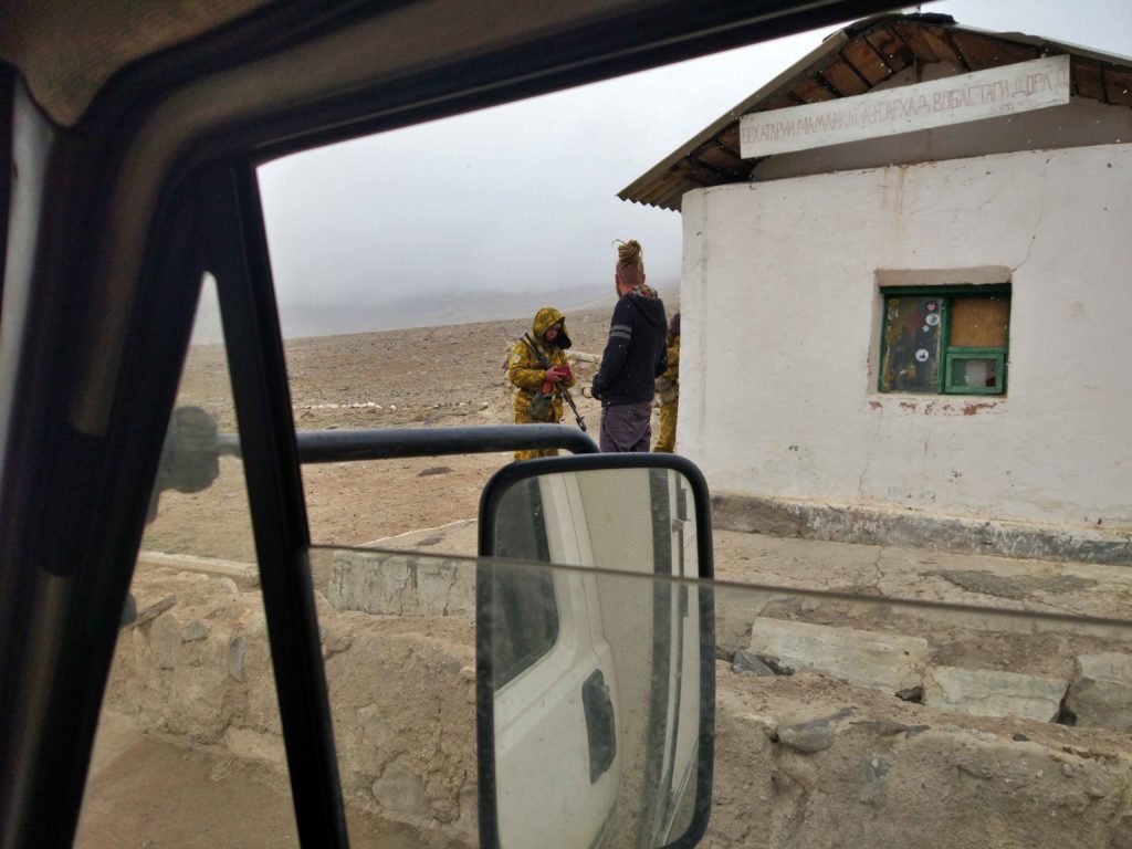
On the checkpoints they just check your papers and write down the details. All the soldiers are very friendly, but be careful if camping near the border river. We did it a lot of times and two times soldiers came and told us to go. Very friendly, but it is annoying if you have to find a new place in the dark.
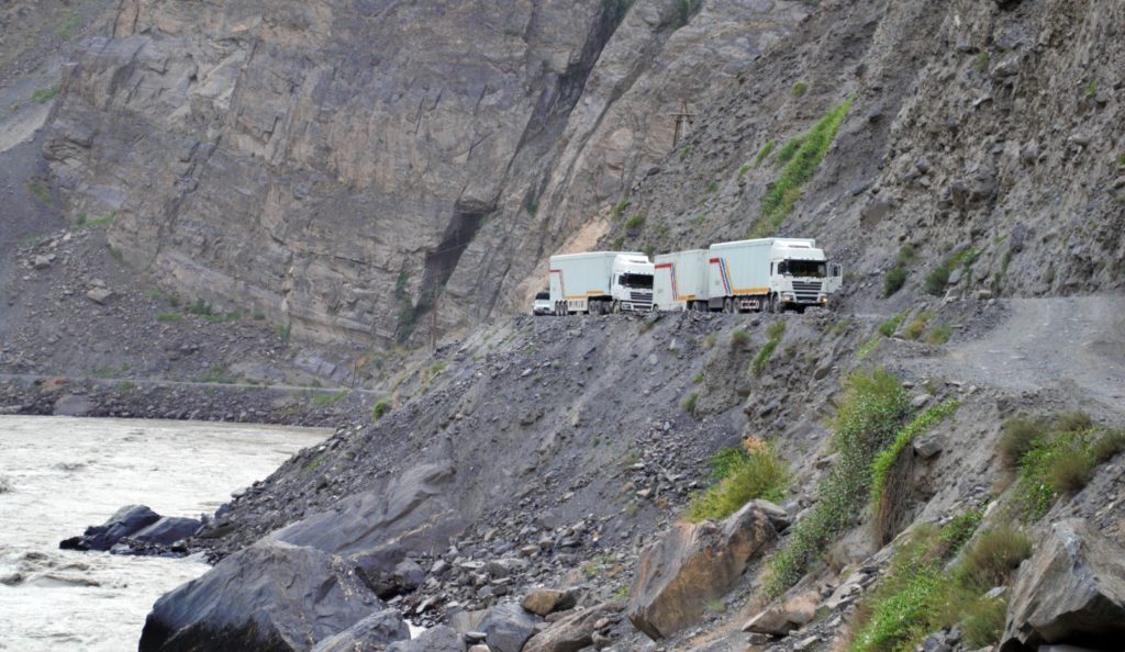
Until Langar there are no villages on the way, just some shelters here and there for the animals. The road is going all the way along the river, sometimes on the same level, other times the river is 50m down off the road.
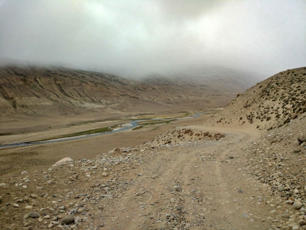
Just before Langar the road is going down, it is a very step part. I guess we would have had problems at this part coming up.
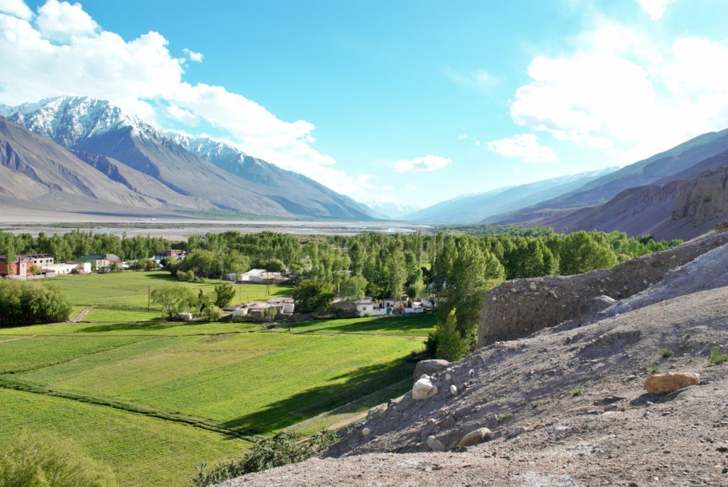
From here you will have this typical picture of the Wakhan Valley. Big, dry mountains the peaks covered in snow, a big river in between with green green trees, fields and small brown houses.
It feels like a small Oasis after the harsh mountains.
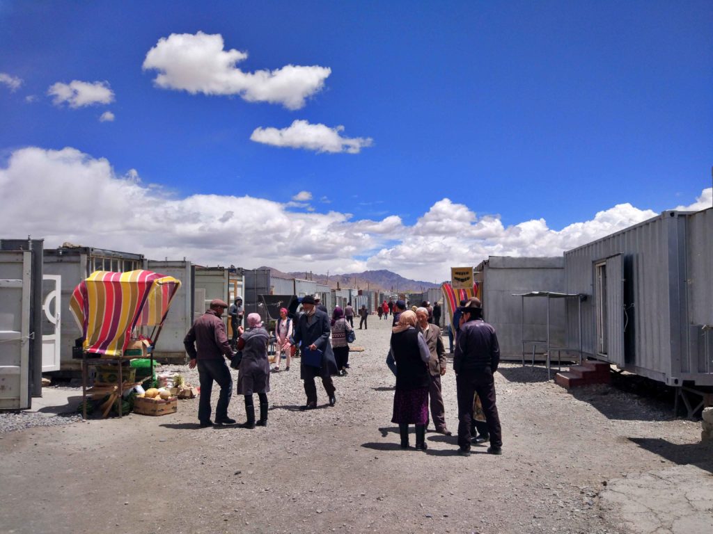
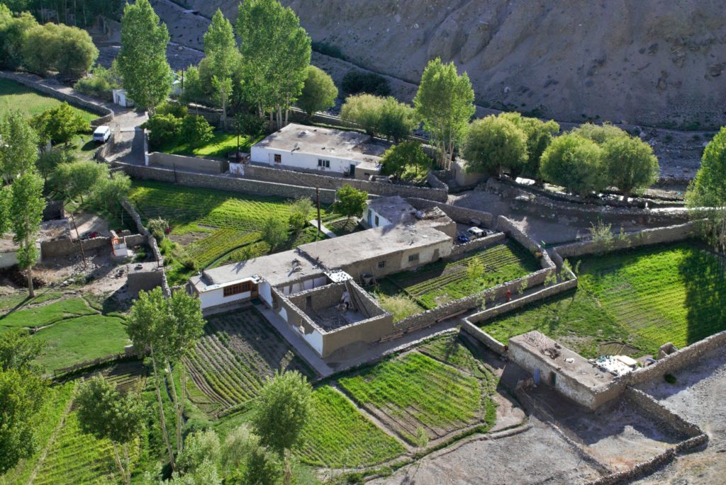
The road between Langar and Khorough passes many small and very beautiful villages. You can find some museums, old fortresses, hot springs and even a Buddhist Stuppa in this villages.
But it is mostly just a place to spent your time! We stopped in some villages, taking a walk to a fortress or hot springs.
It is a very back to basic lifestyle. The houses made out of wood and mud creates a kind of complex with small fields around. All the irrigation of the fields are made with small channels. It is a huge system in which they are open different arms to water different fields.
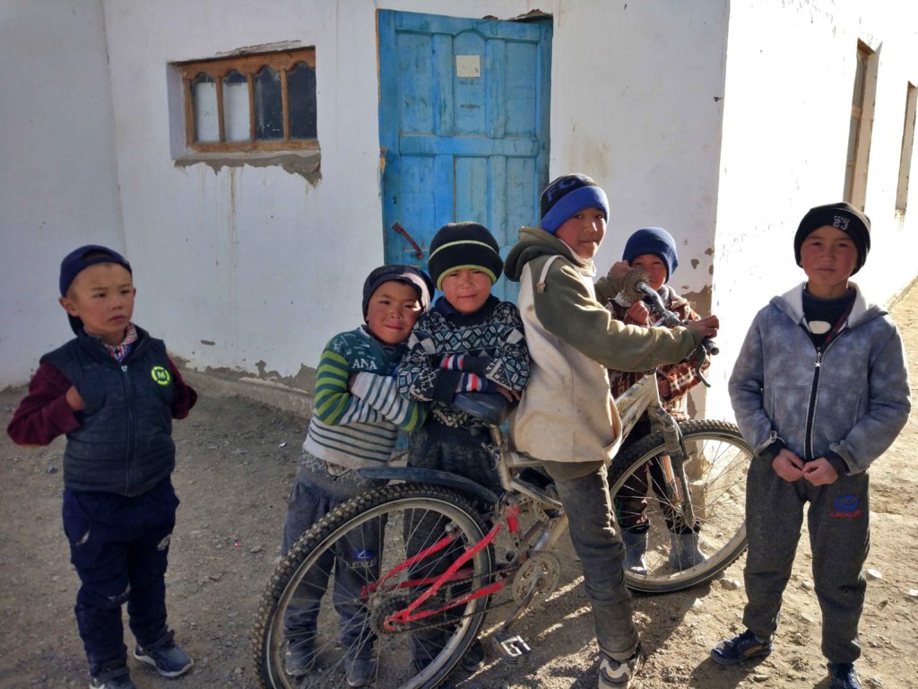
The people are happy to see people who are passing through, especially the kids are very curious and inviting you to play volleyball or soccer with them, so they practice their English with you.
All the time you can also see the villages on the Afghan side, sometimes they are very near and you can observe the life over there.
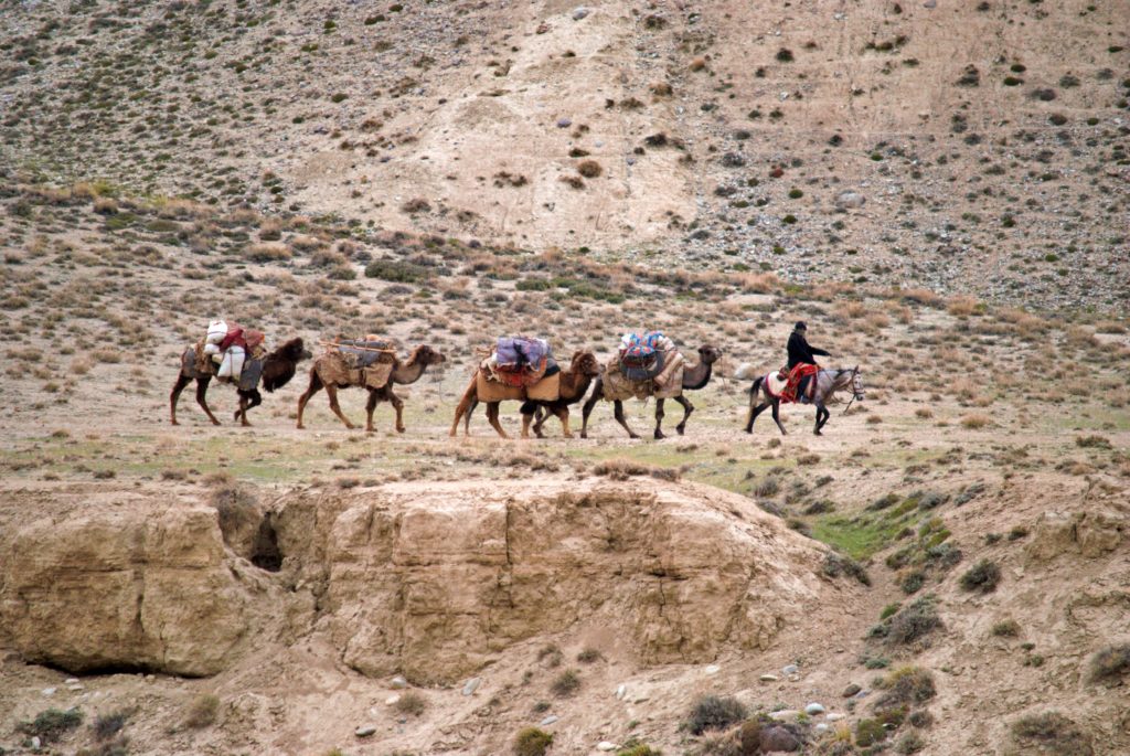
While you will find a lot of cars and small tracks on the Tajik side, you will see more donkeys, camels and motorbike on the Afghan side. As well as also some blue Burkas.
Isma´ilism
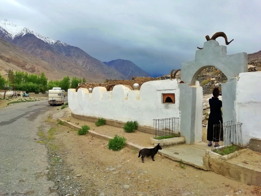
The religion in the Wakhan Valley (like most of Badakshan) is Isma´ilism, it is a more mystic and spiritual stream of the Shia.
You can say it is more open, women are not covering their hair, you don´t find to many mosques in this area instead you can find shrines with goat skulls. The center of the religion is Ali, the son in law of Mohammed who symbolizes like in Alivata believing equality.
The spiritual leader of the Ismailis is Aga Khan, he is one the 10 richest person in the world and is supporting the Ismaili Community with several 100 million Dollars every year.
You don´t realize to much in the Valley, but once you come to Khorough, the capital of the region, you will find the best University in Central Asia, a very good hospital, the small mountain town seems to have good live standard and most of the people speak English, because they went to the Aga Khan University.
Different sources told me that the people in Badakshan could not survive without the financial support of the Aga Khan foundation. It is also a very interesting experience to see how the people live. On one side you see all the traditions in a small agricultural model, meeting a very modern educational and medical center.
If you add some financial support and very affordable access to education and medical help it creates are very harmonic picture.
I say picture, because it looked like that to me. Duygu wanted to join one of their prayer meetings but was not allowed to enter the building while they are praying, we saw that they have a high security alert, controlling all the people who enter the building.
I hope they can keep their harmony and progress in this area. It was good to see it and gave me hope for the rest of the world.
The road to Dushanbe
We spent most of our time in Badakshan, driving from Khorough to Dushanbe took us three days (~500km), because the road is very small, bad and beautiful 🙂
There are several interesting places south of Dushanbe, like springs, fortresses and mausoleums, but with temperatures near 40°C and getting near the end of our Visa we decided to skip this area and drive to Dushanbe, do some shopping, have a pizza and a beer and continue north into the Fan Mountains.
This mountains are connected to the Pamir and separating Khujand from the rest of the country. You will pass through the “Tunnel of death” or also called Ansob Tunnel. It is a 5400 m long tunnel which was notorious because of no light, no tarmac, a lot of water and it had several constructions inside. Nowadays it is still scary but not as dangerous as it was.
The Fan mountains offers a lot of things for people who like nature, 7 lakes, Iskanderkul or Kulikaton lake are the most popular ones.
Because of our time left on the visa we just went to Iskanderkul for cooling down after the heat in Dushanbe.